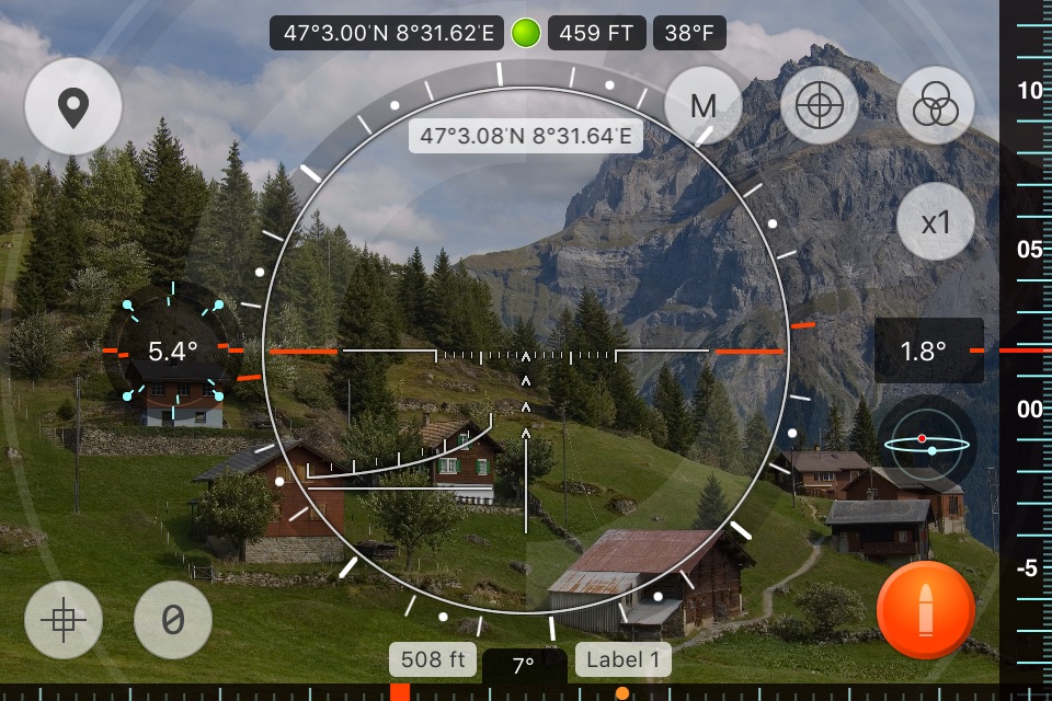
Range Finder is an ultimate distance, height and angle measurement tool with augmented reality, compass and inclinometer. Range Finder turns your device into a powerful measurement multi-tool!
RANGE FINDER TOOL. Measure the height and distances to objects using a set of 8 sniper scopes.
MAP DISTANCE MEASUREMENT. Multi-point distance measurement: just add several points and measure distance between them.
RADIUS AND ANGLE MEASUREMENT. Using radius map overlay measure an angle between two points and display a radius.
WAYPOINTS. Add waypoints on the map with a long tap. You can choose icons, images and audio notes for each waypoint.
TRACKING. Track waypoints using their azimuth and distance overplayed on the camera view or compass screen.
COMPASS. Compass is overlayed on the map to show Sun and Moon rise and set azimuths as well as stored waypoints. When waypoints go off the screen, you can still track them using tracking labels on the border of the screen.
AUGMENTED REALITY VIEW. Use 3D augmented reality camera view to show positions and directions to waypoints.
SCREENSHOTS. Take screenshots with all the on screen data just with a single tap.
USER MANUAL AND HELP PAGE. Get more detailed user manual for each function right from the app: Options -> Help. You can also read the help page online:
http://LifewareSolutions.com/trackkit/manual/rangefinder_ios.html
The manual covers more in-depth topics:
- How to use optical range finder scopes or distance measurement
- How to use 3D augmented reality view
- Object height calculation from A-B elevation angles
- Distance from A-B elevation angles
- Distance and height from A-B elevation angles
- A-B delta angles
If you like Range Finder, please write us a review on iTunes. Your support would greatly help us make the application even better!


